Ballanger Creek Trails – Ballanger Creek Habitat Enhancement Site- Bass River State Forest – Tuckerton, Ocean County, NJ
Distance – 2 total trail miles, but I did 2.5 because I wasn’t brave enough to go over the remains of the bridge
Type – Series of loop trails, although the one will be an out-and-back on each end unless you are braver than me.
Difficulty: 3 of 10. 8 of 10 if you try that bridge.
Website – Bass River State Forest
Open – Sunrise to Sunset.
Terrain – Forest, swamps, wetlands, meadow
Surface – mostly dirt and sand
Trailheads –
N 39° 35.600 W 074° 23.642 (one end of Creek Trail at southern end of parking lot)
N 39° 35.636 W 074° 23.659 (Creek Trail and Field Trail join trailhead)
N 39° 35.667 W 074° 23.681 (Field trail trailhead) – this is the one I started at, although I passed all three on this trek
Directions – 5962 US-9, Tuckerton, NJ 08087
Parking – moderate sized lot

Dog friendly? Yes.
Stroller friendly? The meadow trail would work for a heavy duty stroller. The rest would probably not.
Benches? No?
Facilities?: None here, but lots including bathrooms and camping at the main part of the forest a ten minute drive away.
Markings – Painted blazes and some signs at corners.

Map – Official Trail Maps (trails are in lower right hand corner)
 Cropped section of the state park map that is needed for here.
A hunting reminder:

Description –
Ballanger Creek Habitat Enhancement Site. (pronounced “Baa-lan’-ger”). Ballanger Creek Annex. Either way, this chunk of Bass River State Forest sits off on its own in Tuckerton, up against the Forsythe National Wildlife Refuge. A blog post by Ben Wurst in 2012 on the Conserve Wildlife Foundation of New Jersey website shared some background:
Common along much of the coast of New Jersey, this site has had a lot of use in its history. A saw mill once operated here in the mid-19th century and in the early 1900s fields along the creek were used for agriculture. It was also used as a dump site for fill and other debris. A house and several out buildings were demolished when the property was acquired by the Green Acres Program in the mid-90s. Since its acquisition the site has not been actively managed for wildlife. That all changed in late 2009 when Conserve Wildlife Foundation of NJ acquired funding through the American Recovery and Reinvestment Act of 2009 to enhance the degraded wildlife habitat on site. We’re all done with the project and there’s a lot to explore here. We invite you to explore this site and enjoy its natural beauty and its wildlife residents.
I feel invited! I felt so invited, that I made this my fourth and final hike of Teacher Convention Friday back in November when I’d played hooky the second day (previous hikes being Cameron Wildlife Refuge, Galloway Township Nature Preserve, and the Port Republic Nature Preserve), checking off a second one off my “to hike” list that had been on there for a decade.
There are three trails here – the Field Trail (yellow blazed – 0.4 miles total), the Forest Trail (green blazed – 0.6 miles total), and the Creek Trail (red blazed – 1.0 miles total). After parking, I walked back down the driveway, past the combined red and yellow blazed trailhead and turned right onto the Field Trail at the yellow blazes just before the road.
 Up the driveway toward the road.
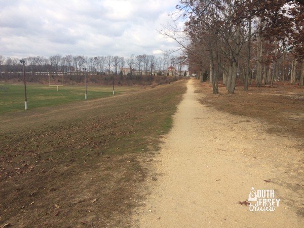
 Right turn onto the yellow blazed Field Trail.
This is the shortest of the trails, the most clear, and the easiest to navigate. It makes a loop through an old field that is going through the stages of forest succession. This second week of November, it had some nice color left in the leaves. It also had nature signs along the way to teach you about what you were looking at, the only trail of the three to do so. I took it halfway until it’s junction with the red blazed Creek Loop Trail.


 Trail junction with the red trail.
At the junction, the red trail actually heads both ways. To the right, it overlaps with the yellow trail that I’d been hiking, the trails overlapping for about another 0.2 of a mile back to the entrance driveway. So I headed left, into the woods and away from the cars, following the red-by-themselves blazes.
What looked on paper like a little straight shot connector to the green blazed Forest Trail turned out to be an interesting little stretch. The trail quickly entered some muddy areas with some boards over them, and then looked impassable up ahead. Oh no, I thought to myself.
But the trail didn’t follow what looked like the natural pathway, instead curving left and climbing slightly to the edge of what surely was one of the old cranberry berms. I actually climbed after seeing a hint of water without noticing the blazes went that way, climbed down, looked behind me and saw the blazes, and went back up. The trail follows the berm, keeping my feet mud free for the moment. Hooray!
 Not usually a great sign.
 But it was a great sign. Thanks trail climbing above the mud.
 There is is, trail marker.
 Trail.
 A nice view too. Route 9 is in the background there, you could see the cars passing.
The trail dropped slightly into what I had expected, forest. The floor was remarkably clear here, and I had to keep an eye on the blazes to make sure I was still on the trail. I soon arrived at the junction of the green and red blazed trails.
 Tree stand.
 Lots of shells.
 Next intersection.
To the right, the red blazes would overlap with the green for a short distance before heading off on their own. I opted for left so that I could do the green blazed Forest Trail (0.6 mile loop) before doing the red trail. This trail was wide and easy to follow, as it was mostly an old road. There were spots that were overgrown with grass, so beware of ticks and chiggers.


The first length done, I followed the trail right to head southeast on the back stretch. Some of this stretch was a little grassy.


A right turn onto a much clearer old road bed went south and then southwest.


The trail finally headed northwest until it met the red/green trail overlap that we’d skipped at that first intersection (although this is not that intersection, although it is very close to it). More grassy sections along the way. Ticks are cheering, hooray!


 Just a forest friend chewing on a snack.


At the green and red junction, it was time for what I assumed (correctly for once) would be the highlight – the red blazed Creek Trail. I turned left at the junction. The trail was, ummm, interesting. It was just fine at first, but got narrower and narrower and wetter and wetter as I went on. Adventure!


Just when it began to get wet enough that my sneakers might not be cutting it, boards appeared to help with the wettest stretches.


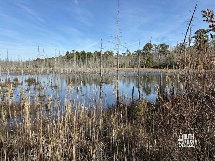
Finally, the views of Ballanger Creek appeared. Worth it!
 Hooray!
And while I had a good idea that the loop didn’t really loop anymore, was still a bit of a bummer when I reached what’s left of the foot bridge.
 Ugh.
Surely, I’m not dumb enough to cross the bridge. Of course I’m not dumb enough to cross that bridge!
I was dumb enough though to cross half the bridge before coming to the decision that I wasn’t crossing that bridge. Lost my nerve about stepping onto the planking, because I’ve had a lot less nerve about that stuff since I spent most of 6 months on crutches with a sprained foot that I kept reaggravating a few years back (COVID lockdown eventually fixed it), and I was afraid it would roll or twist on me if I tried to jump on it.
Which left one choice… a longer hike by backtracking! This is not a terrible think, one who is on his fourth hike of the day isn’t too worried about an extra half mile of walking. So turned around, back down the red trail to the intersection with the green. Down the combined red and green trails until they split. Hanging a left there for that neat little stretch of red trail by what I think was a bog. Finally, I arrived back at the yellow blazed Field Trail. This time, I went left to complete the last bit of that loop where the yellow and red blazes overlap.


Turning left onto the driveway, I walked past the car to find the final trailhead at the south end of the lot. There, I rejoined the red blazed Creek Trail.

 Around the gate.
This stretch of trail went pretty quick. Easy walking with a some views of the creek to my left did slow me down some, as they usually do.


The trail then turned left and curved up onto another old bern.


There’s the creek again.A short walk along the top of the bern brought me back to the broken bridge again. I was tempted to try it out from this side, but I decided not to risk driving home soaking wet.

 View down stream, out of the state forest.
 Not today.
So I once again turned around and headed back for the parking lot. Five hikes today maybe? No, was calling it! Seven hikes in two days (six of them on new-to-me trails) would have to do!

Ratings:
What I liked:
The water views of the creeks and pond were great. Lots of interesting bits to check out along the trail.
What could be better:
That bridge and the grass on the trail.
Overall rating – 6 of 10. A great finale to two days of adventuring.
Nearby: The main part of Bass River State Forest has hiking and camping and also has the beginning of the Batona Trail. Forsythe National Wildlife Refuge has adjacent property, although the hiking trails are not next door.